Tutorial Stream and Catchment Delineation using PCRaster in QGIS
8. Delineate Streams
8.5. Styling the channels
Next you will style the channels to get a better understanding of the results.
1. Open the attribute table of the channels layer.2. Click the Field calculator button 
3. In the Field Calculator dialogue create a new field ORDER with Output field type Whole number (integer) and Output field length 1. Under Expression write the code as given below:

4. Click OK.
5. Toggle off editing by clicking  and save the edits. Close the attribute table.
6. Open the Layer Styling panel and set the target layer to channels.
7. Choose the Graduated renderer with the following settings:
- Set the Value to ORDER and the Precision to 0 since Strahler Order values are integers.
- Set the Method to Size.
- Set the Size from values from
0.3to1.0mm. - Set the Mode to Equal Interval with the same number of Strahler Order classes that exist in your data. Review the attribute table if need be. In this example it is set to 3 classes. Click Classify.
- Set the Legend values to integer Strahler order values. Note that the first range always includes both the minimum and maximum value. The other ranges exclude the minimum value and include the maximum value.
8. Click the Change button and set the Color to an RGB value of 15 | 66 | 220.
9. Click the Go back button to return to the main symbology panel.

You might have noticed the the lines are not very smooth as river lines should be. We'll make them smoother to make them look more realistic.
10. In the Processing Toolbox click the Edit features In-Place button  . This will select tools that can be applied to vector layers without saving a copy.
11. Look for the Vector geometry | Smooth tool.

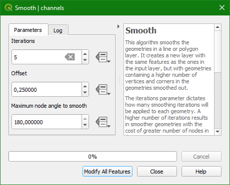
12. In the Smooth dialogue change the Iterations to 5 (the higher the number, the smoother the line). Keep the other values as default and click Modify All Features.

13 Click Close.
14. Toggle off editing mode and save the edits.
15. Click  to deselect all features.
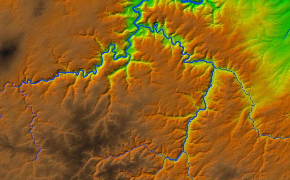
Your map should now resemble the figure below, showing the streams identified as having higher Strahler Orders are the main channels and the smaller ordered streams
are tributaries.
