Share your results!
1. Show us your maps
1.3. Create a Map
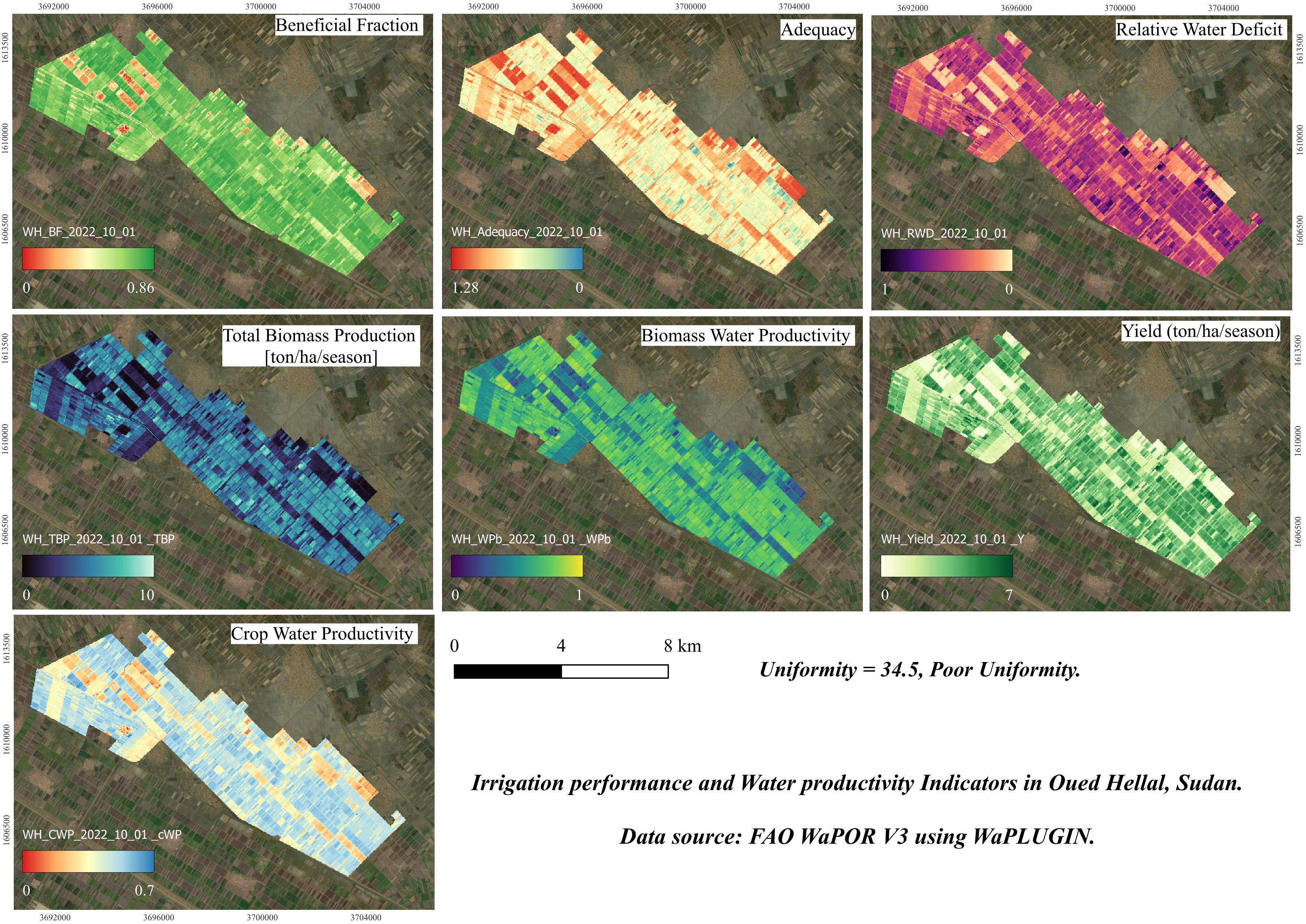
We're going to create a map in the Print Layout.1. To create a map, go in the main menu to Project | New Print Layout and give the layout a name (e.g., Oued Hellal Indicators Map).
2. In the Print Layout window, click on the Add Map
3. Drag the mouse to create a map frame in the layout, which will display the view from your QGIS project.
4. Choose the Add Label
- You can customize the font,
size, and color in the Item Properties panel.
- You can adjust the title
and format the legend using the Item Properties panel.
- In Item Properties, you can adjust the units (e.g., meters or kilometers) and the scale.
8. Choose a file name (e.g., Oued_Hellal_Indicators_Map) and save the map to your computer.