Tutorial: Delineate multiple (sub)catchments
2. CSV with outlet coordinates
In the previous tutorial, you have delineated the catchment for one specific outlet. The CSV file that you have created can be extended with multiple locations. Each location should have its own ID number.
1.Open QGIS with the project of the previous tutorial.
2. Define multiple outlet coordinates in a CSV file by repeating this section of the previous tutorial.
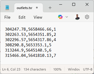
For example, in this screenshot, there are seven outlets for which we want to derive their (sub)catchment. It follows the pattern: x,y,id.
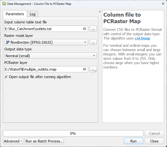
3. With the Column file to PCRaster map we can convert this CSV to a nominal raster with the ID numbers as pixel values.
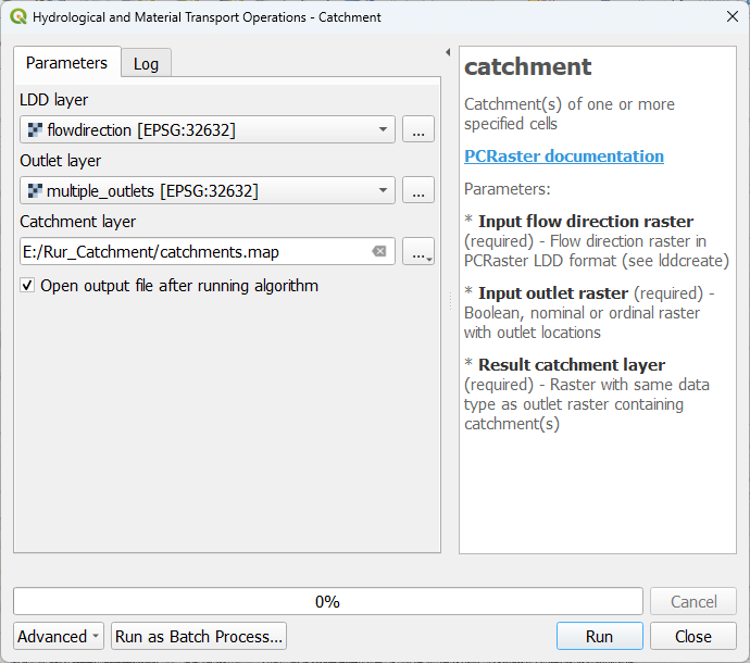
In the previous tutorial, we have used the catchment tool to derive the catchment of the single outlet. Here we can use the same tool for deriving multiple catchments.
This is then the result. We can apply the same colours as the outlets by copy/pasting the styling.
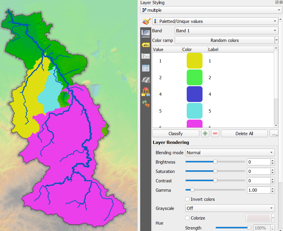
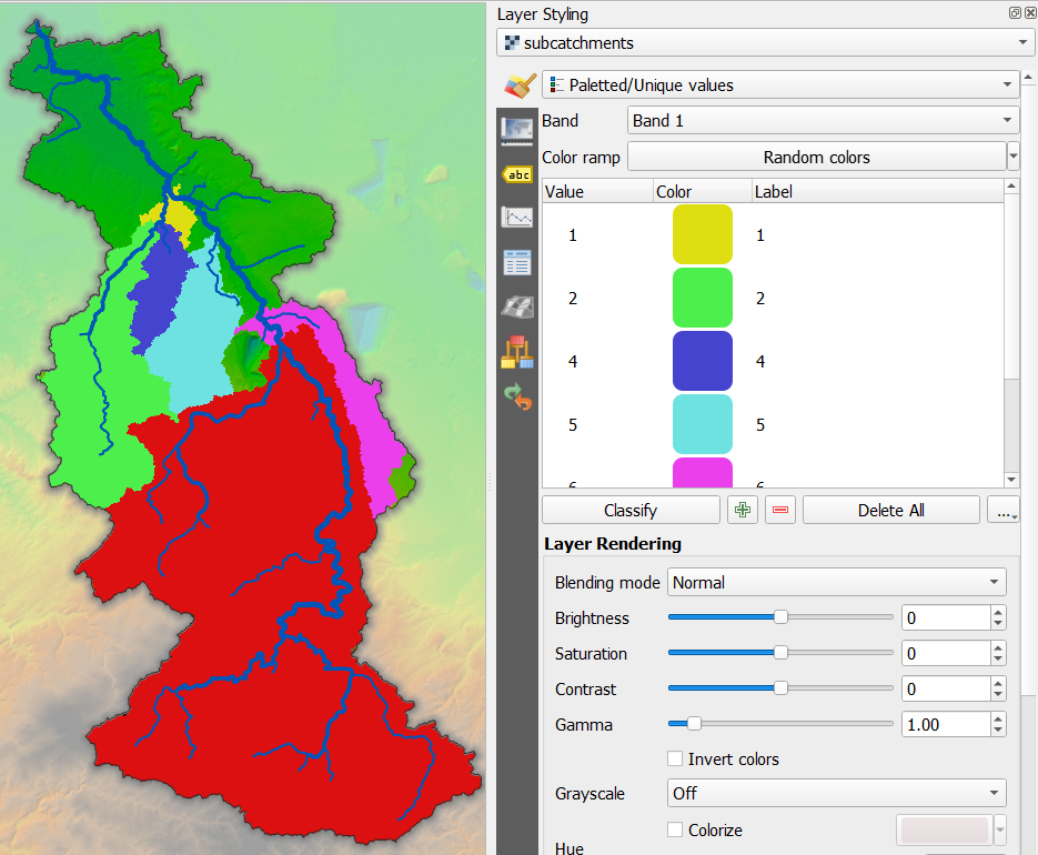
Here you see that you only have three of the seven catchments. If you have defined an outlet upstream of another outlet, the catchment tool will let the downstream catchment absorb the upstream catchment. If you're interested in seeing the division between the two subcatchments, you can use the subcatchment tool.
Here you can see the result of the subcatchment tool for the same outlets.
Sometimes you don't have the coordinates and just want the software to determine the outlets automatically. The next chapters show two methods for automatically finding outlets and deriving their (sub)catchments.