Tutorial: Stream and Catchment Delineation
6. Fill Sinks and Calculate Flow Direction
Raw, unprocessed DEMs have artifacts such as depressions. Artifacts are a result of the DEM acquisition process and must be removed before a DEM can be used for hydrological analysis, like catchment and stream delineation or hydrological modelling. There are several algorithms for filling sinks. Here we'll use the native Fill Sinks (Wang & Liu) tool. This tool fills the sinks and creates a filled DEM suitable for further hydrological analysis.
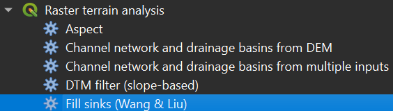
- In the Processing Toolbox, go to Raster terrain analysis | Fill sinks (Wang & Liu).
2. In the dialog, choose dem_subset as Input layer. Save the Output layer (filled DEM) as dem_filled.tif and Output layer (flow directions) as flowdirections.tif.
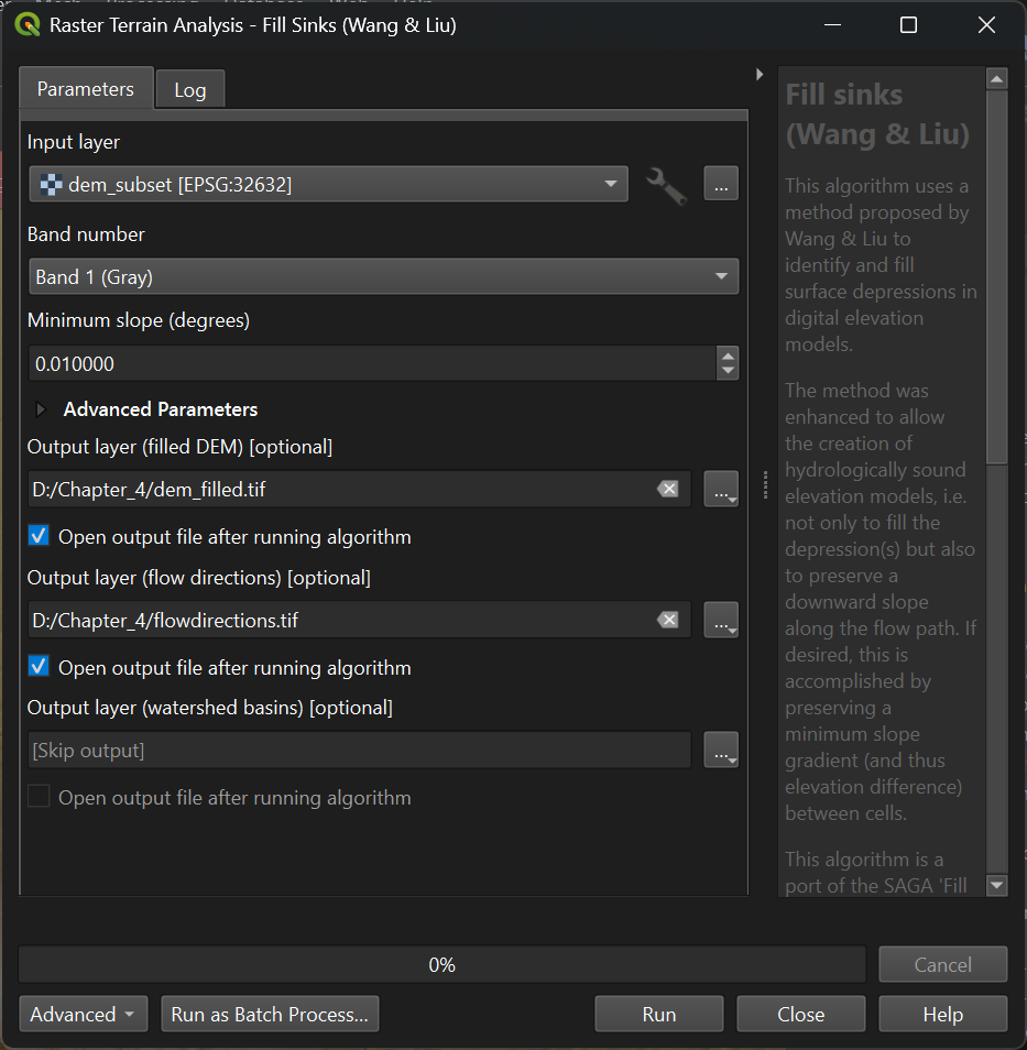
3. Keep the rest as default and click Run. Click Close after processing.