Tutorial: Stream and Catchment Delineation
7. Delineate Streams
7.1. Calculate Strahler Orders
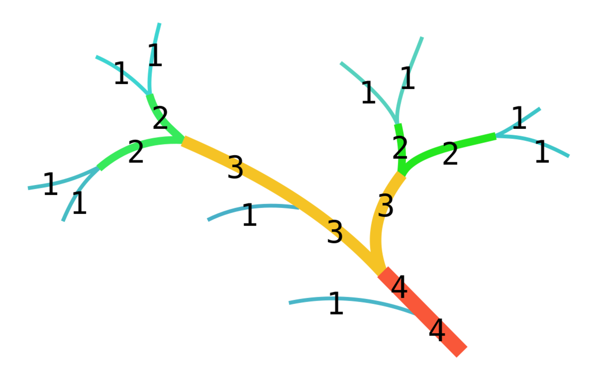
Before we can derive the streams from the DEM, we need to determine what we consider streams. For this purpose we use the Strahler order. The higher the order, the bigger the stream.
1. Close the 3D Map view and show only dem_subset with blended hillshade by unchecking the other layers in the Layers panel. Also zoom out to the full extent.
2. Search for streamorder in the Processing Toolbox and select PCRaster | Hydrological and transport operations | streamorder.
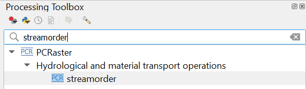
3. In the Streamorder dialog, select flowdirection for the Local Drain Direction layer, use strahler.map as the Stream Order output filename, and click Run. Click Close when the algorithm is done.

To make more sense of the strahler layer we are going to style it.
- Is the Strahler order layer a Boolean, discrete, or continuous raster?
The Strahler order layer is a discrete raster, but the order of the classes is important. Therefore, for PCRaster, it has the ordinal data type. For discrete rasters in QGIS we use the Paletted/Unique values styling. The higher the Strahler
order, the bigger the stream. So we will use a color ramp from white to blue.
4. Open the Layer Styling panel if you closed it before and make sure that the strahler layer is selected.
5. Choose Paletted/Unique values from the drop-down menu.
6. Click Classify.
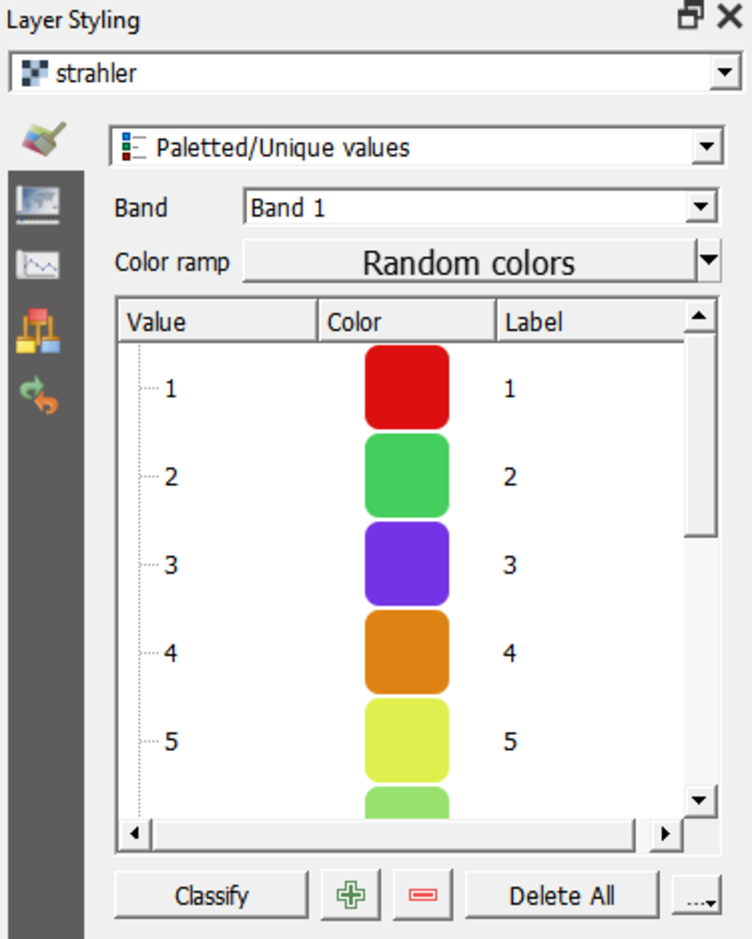
This assigns a unique, random
color to each unique value in the raster.
7. Right-click on Random colors and choose Blues.
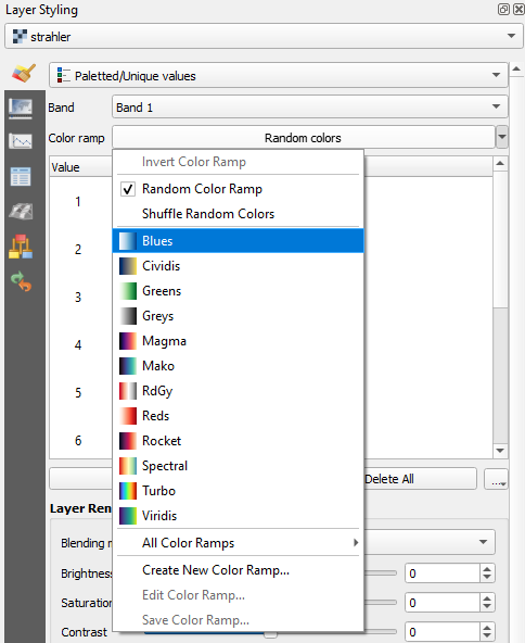
The strahler layer now shows in an intuitive way that
the higher orders will be larger streams than the lower orders.

Watch this video to check the steps in this section: