Tutorial: Stream and Catchment Delineation
Completion requirements
6. Fill Sinks and Calculate Flow Direction
6.1. Install the PCRaster Tools plugin
PCRaster is a powerful package of software for map algebra and environmental dynamic modelling. The main applications of PCRaster are found in environmental modelling: geography, hydrology, ecology to name a few.
An extensive set of raster operations is available: several point operations (analytical and arithmetical functions,
Boolean operators, operators for relations, comparison, rounding, field generation etc.), neighbourhood operations for calculations in moving windows (highpass filtering, edge filtering, moving averages, etc.), area operations for calculations within
specified areas (for instance soil groups), operations for the calculation of cost paths. In the PCRaster package a rich suite of geomorphological and hydrological functions is available. These include functions for visibility analysis, catchment analysis
and routing of transport (drainage) of material in a catchment using interactively generated local drain direction maps and transport (routing) operations. These operations are made available in the QGIS Processing Toolbox through the PCRaster Tools plugin.
Before you can install the PCRaster Tools plugin you need to install PCRaster.
On Windows you can install PCRaster with the OSGeo4W installer. Alternatively you can install PCRaster and QGIS in conda. Below are the steps for installation on Windows, which you should only do if you have missed the steps when following the installation instructions of QGIS for this course. Otherwise continue from Step 13.
- Save your QGIS project and close QGIS
- Run the OSGeo4W setup which comes with your QGIS version
- Choose Advanced Install, click Next
- Choose Install from Internet, click Next
- Select the root install directory or keep the defaults, click Next
- Select local package directory or keep the defaults, click Next
- Select your internet connection, click Next
- Choose one of the download sites, click Next
- In the Select Packages window search for
pcraster - Click the arrows icon to change from skip to a PCRaster version to install:
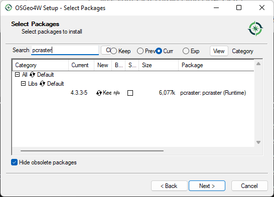
- Click Next to complete the installation
- Click Finished to close the OSGeo4W Setup wizard
For Linux, Max and Windows you can also use PCRaster and QGIS in Conda. Check the plugin documention for instructions to install it in Conda.
13. Start QGIS Desktop
14. In the main menu choose Plugins | Manage and install plugins...
15. In the dialog search for
pcraster and install the PCRaster Tools plugin.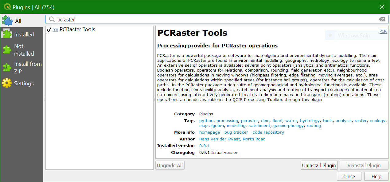
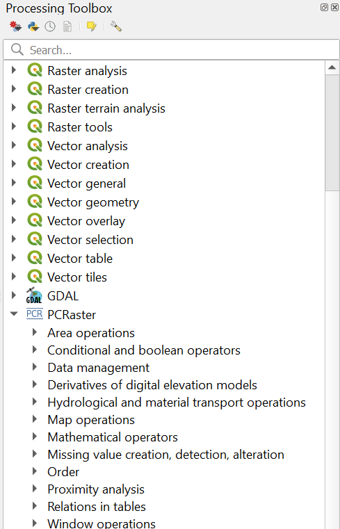
16. After successful installation you'll see the PCRaster Tools in the Processing Toolbox:
In the next section we'll convert the DEM GeoTIFF to the PCRaster format, which is needed to use the PCRaster tools.