Tutorial Stream and Catchment Delineation using PCRaster in QGIS
7. Fill Sinks and Calculate Flow Direction
7.2. Convert GeoTIFF to PCRaster Format
In order to use the PCRaster tools we need to convert raster to the PCRaster map format, which is a GDAL supported format. This is needed, because PCRaster is strict with data types.
PCRaster distinguishes the following raster data types:
- Boolean: cells are 0 (False) or 1 (True)
- Nominal: cells have positive integer values representing classes (discreet raster) without a specific order, for example land-use classes
- Ordinal: cells have positive integer values representing classes (discreet raster) with a specific order, for example stream order.
- Scalar: cells have real values (decimal, positive, negative). This is used for continuous rasters.
- Directional: for rasters with a compass direction (e.g. aspect).
- LDD: local drain direction, a specific data type for flow direction rasters
During calculations, PCRaster checks the data type of the input rasters. Calculations can only be done when the correct data types are used.
Here we'll convert the DEM from section 6 to PCRaster format.
1. In the Processing Toolbox go to PCRaster | Data management | Convert to PCRaster Format.
2. In the Convert to PCRaster Format dialogue choose dem_subset as Raster layer and Scalar as Output data type (the DEM is a continuous raster). Save the result to dem.map.
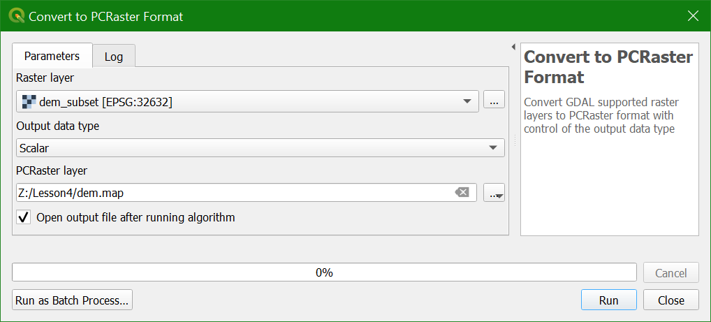
3. Click Run.
The result is now added to the map canvas.
We'll continue to derive the flow direction map from dem.map in the next section.