The FAO Downloader Plugin
3. Add a backdrop Google Satellite layer
To make orientation easy, we're going to add a Google Satellite backdrop, using the QuickMapServices plugin.
1. In the main menu go back to Plugins | Manage and Install Plugins....
2. Go to the All tab.
3. Search for the QuickMapServices plugin.
4. Click Install Plugin and click Close to close the dialog after installing.
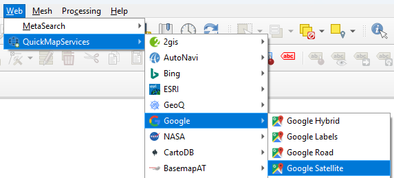
You can now find the plugin in the web menu, but it lacks a lot of useful services. Let's fix that.
5. In the main menu go to Web | QuickMapServices | Settings.
6. In the QuickMapServices Settings dialog, go to the More Services tab and click Get contributed pack.
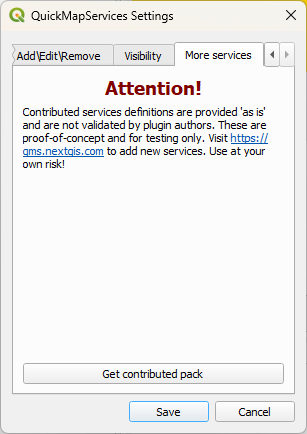
7. After installing click Save to close the dialog.
8. In the main menu go to Web | QuickMapServices | Google | Google Satellite.
9. Zoom in on the area of your interest.
Tip: you can use the Locator bar in the lower right of the QGIS window to find a location. Start the search with > and a space, e.g.:
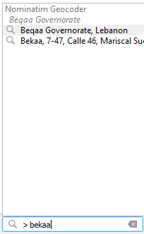
Then double click on the location to zoom in.
In the next chapter we'll digitize a polygon of our study area. If you already have a polygon, you can proceed with chapter 5.