The FAO Downloader Plugin
6. Download data
Now we have access to the FAO API, we are ready to download data.
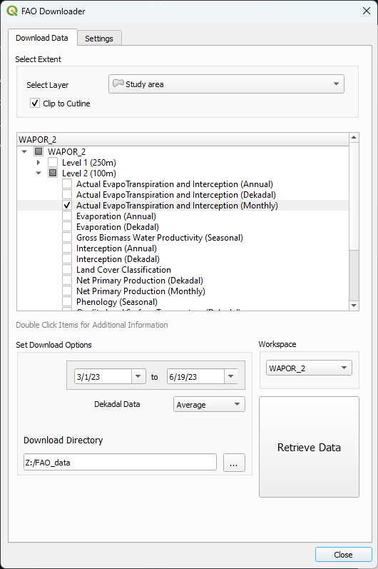
1. In the FAO Downloader plugin dialog go to the Download Data tab.
2. Under Select Extent, select the Study area polygon layer. This must be a single polygon layer.
3. Keep the Clip to Cutline checkbox checked. In this way the downloaded raster will be clipped to the study area polygon. When you uncheck the box, a rectangular raster will be downloaded.
You can download data from different FAO repositories. These are called workspaces.
4. Select the WAPOR_2 Workspace from the drop down list if it's not chosen by default.
5. Expand the tree of checkboxes in the center of the dialog to select which datasets you want to download.
6. Expand Level 2 (100m) and double click on Actual EvapoTranspiration and Interception (Monthly).
This will show you the metadata, including the units of the raster layer.
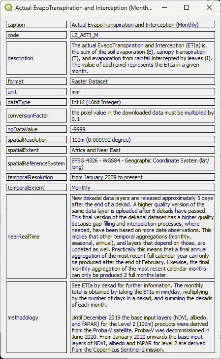
7. Close the metadata popup and check the box of the Actual EvapoTranspiration and Interception (Monthly) layer.
8. Define the date range. Here we choose from 1 March 2023 - 19 June 2023.
Note that for Dekadal data we need to define the format. By default, FAO supplies this data as average. You can change it to cumulative values if needed.
If you want to use the default Dowload Directory set under the Settings tab, you don't need to add a Download Directory here.
9. Click Retrieve Data to download the rasters.
The plugin shows the progress of the download.
10. Click Close to close the dialog.
In the next chapter we'll inspect the downloaded data.