3D with QGIS and Aerialod
2. Calculate Flow Direction
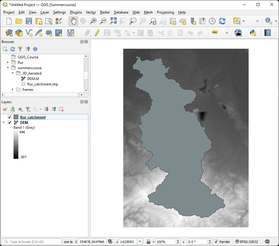
The layers that we use have been prepared using the stream and catchment delineation procedure with the PCRaster Tools in QGIS, which is not covered in this tutorial. The layers are provided in the tutorial data that you can download from the main course page. Let's load the layers.
1. Open QGIS Desktop with a new project.
2. Use the Browser panel to locate the files that you've downloaded.
3. Drag the DEM.tif and Rur_catchment.shp files to the map canvas.
We'll first concentrate on the DEM and derive the flow direction that we need as an input to calculate the distance to the rivers.
4. Hide the Rur_catchment layer by unchecking its box in the Layers panel.
5. In the Processing Toolbox go to PCRaster | Data management | Convert to PCRaster Format.
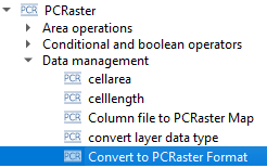
6. In the Convert to PCRaster Format dialog choose DEM as Raster layer, Scalar for the Output data type (it's continuous data!) and save the result in the folder of the tutorial data with the name dem.map.
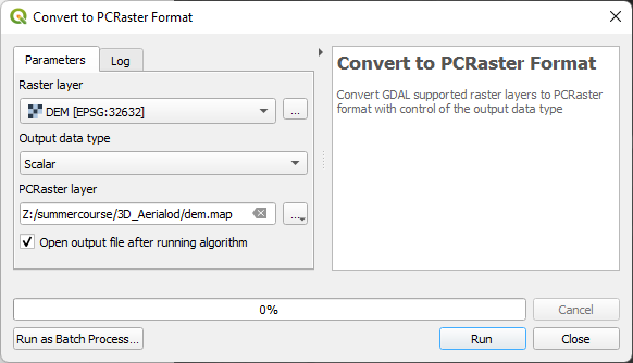
7. Click Run to convert the layer. Click Close to close the dialog.
Now we can calculate the flow direction layer (or LDD).
8. In the Processing Toolbox go to PCRaster | Hydrological and material transport operations | lddcreate.
9. In the Lddcreate dialog choose dem as DEM layer and keep the other parameters as default. Save the result as flowdirection.map in the folder with the data for this tutorial.
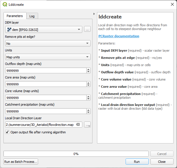
10. Click Run. This can take a few minutes. After processing click Close to close the dialog.
Now we have our flow direction layer we can derive the streams.