3D with QGIS and Aerialod
3. Derive Streams
In this section we're going to derive the streams. You can calibrate Strahler orders or flow accumulation.
Here we'll use the Strahler orders larger than or equal to 8.
1. In the Processing Toolbox go to PCRaster | Hydrological and material transport operations | streamorder.
2. In the Streamorder dialog choose flowdirection as the Local Drain Direction layer and save the result as strahler.map.
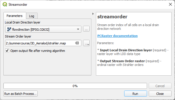
3. Click Run. Click Close after processing.
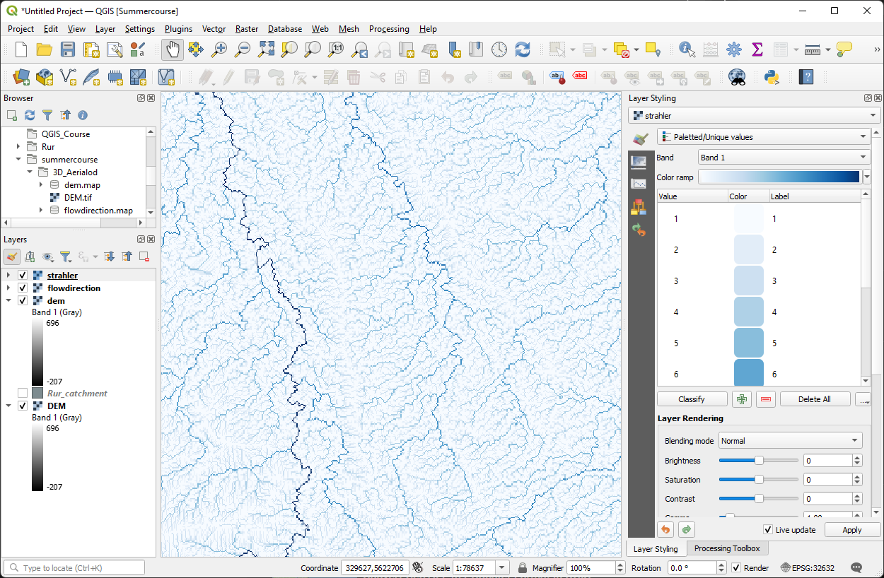
4. Open the Layer Styling panel by clicking . Style the result using the Paletted/Unique values renderer and a blue ramp. We use this renderer, because Strahler orders are ordinal.
We'll consider Strahler orders larger than or equal to 8 as the rivers. In the next steps we'll create a boolean layer with the rivers.
First we'll create an ordinal raster with value 8 for each cell. Ordinal, because the Strahler order raster has the ordinal data type.
5. In the Processing Toolbox go to PCRaster | Data management | Spatial.
6. In the Spatial dialog type value 8 as Input nonspatial, choose Ordinal as Output data type and choose any of the PCRaster layers as Mask layer (all PCRaster layers that we have created have the same dimensions. Save the result as ordinal8.map.
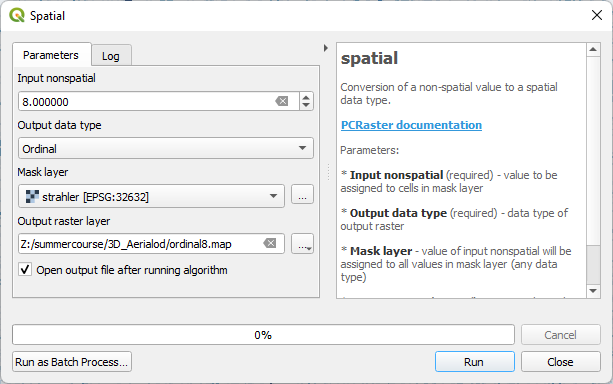
7. Click Run. Click Close to close the dialog after processing.
Now we can calculate the boolean river layer with True for cells >= 8 and False for the other cells.
8. In the Processing Toolbox go to PCRaster | Conditional and boolean operators | comparison operators.
9. In the Comparison Operators dialog choose strahler as Input raster, >= as Comparison operator and ordinal8 as the second Input raster. Save the result as rivers.map.
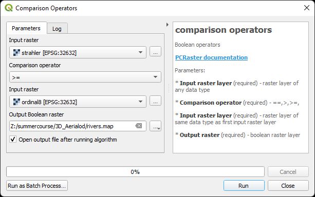
10. Click Run. Click Close after processing.
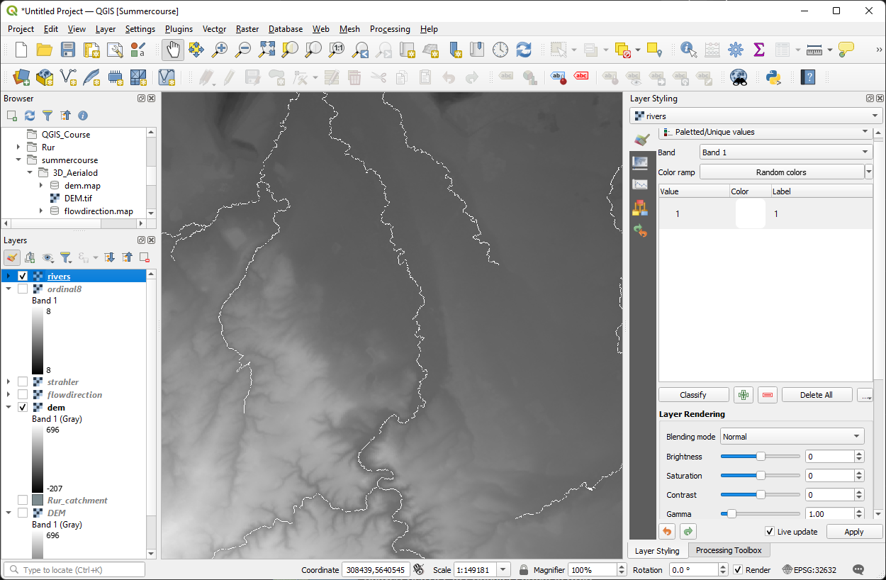
We want the rivers to be white and the other cells to be transparent.
11. Go to the Layer Styling panel and make sure rivers is the target layer.
12. Select the Paletted/Unique values renderer, because rivers is a boolean layer.
13. Click Classify.
14. Select the 0 row and click  to remove it. Then the zero's will be transparent.
15. Change the color of the ones to white.
16. Check the result by only showing the rivers over the dem layer.
Now we're ready to calculate the distances to the river.