3D with QGIS and Aerialod
5. Finalize the Styling
In the next section we'll visualize our result in 3D using Aerialod. Aerialod expects a grayscale png file where black is low and white is high.
Let's style our map in such a way that it shows nicely in Aerialod.
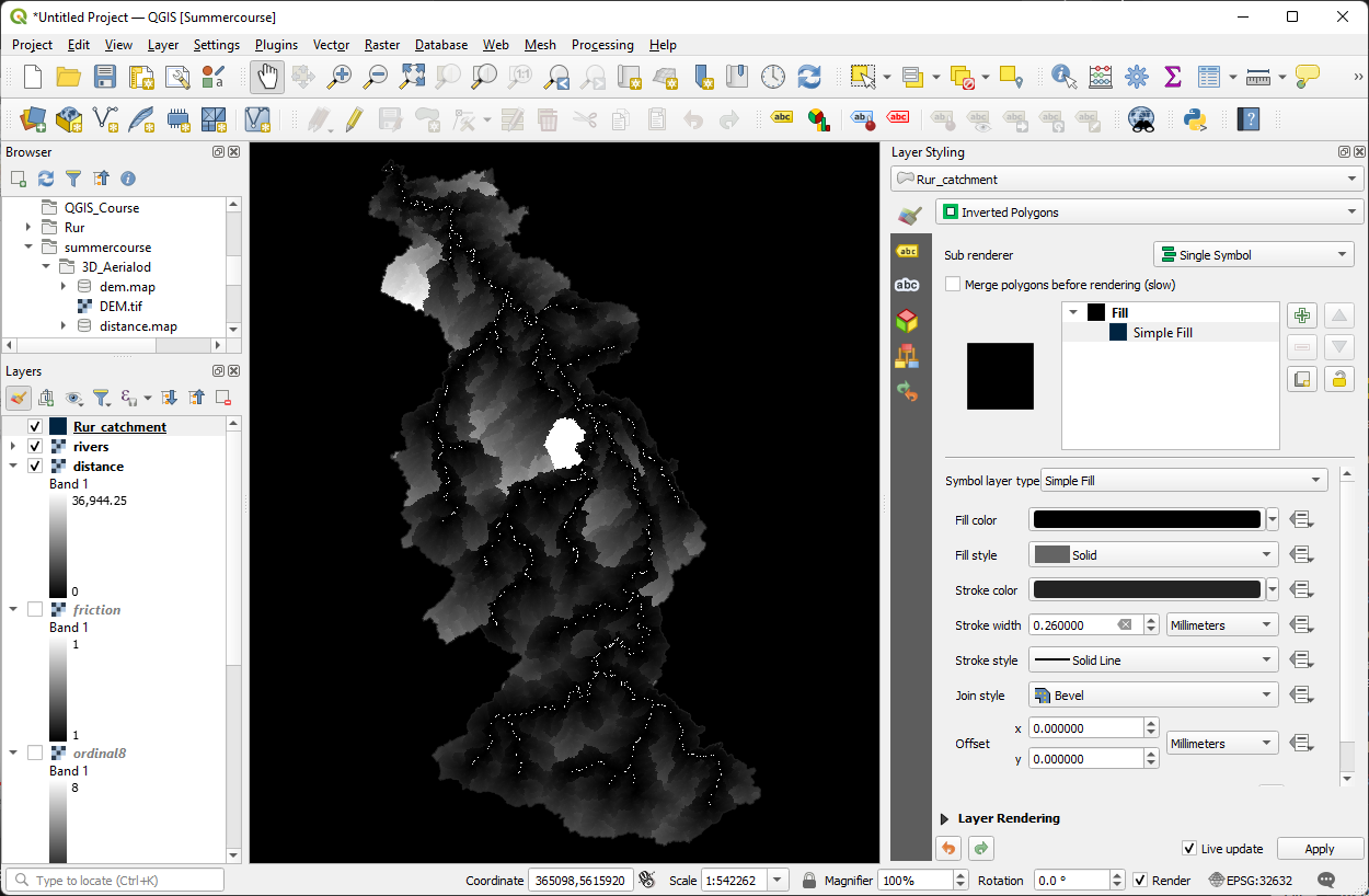
1. Reorder the layers in such a way that the Rur_catchment polygon is on top, followed by the rivers layer and at the bottom the distance layer. Hide all other layers.
We're only interested in the area inside the catchment boundary, so we're going to create a black mask for the outside area, because black will result in the lowest height in Aerialod.
2. Go to the Layer Styling panel and make sure that Rur_catchment is the target layer.
3. Change the Single Symbol renderer to Inverted Polygons.
4. Click on Simple Fill and change the Fill color to black.
It would be good for the user to see some places as a reference. We can add some places from OpenStreetMap using the QuickOSM plugin.
5. Make sure you've installed the QuickOSM plugin from the plugins manager and click  to open the dialog.
6. Use Key=place and Value = city. Make sure that you only download the cities for the Canvas Extent and that you choose Points.
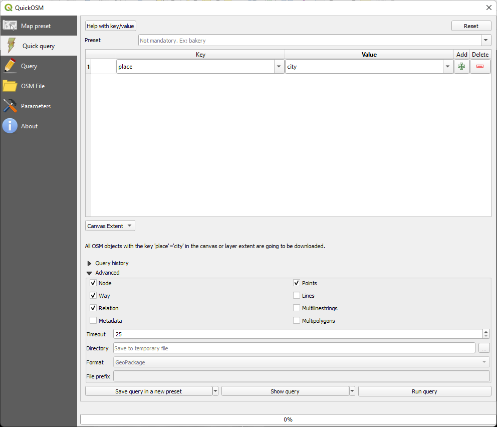
7. Click Run query and close the dialog when it's done.
Now the cities have a random color. To make them stand out in the 3D map, we need to make them white.
Also note that the city layer is a temporary scratch layer indicated with the  icon. Let's make it permanent before we continue.
8. Click on  and save the scratch layer as cities.shp.
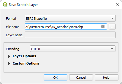
9. Click OK.
Now the is gone and we know that the layer is saved.
10. Go to the Layer Styling panel and make sure that the place_city layer is the target layer.
11. Choose the dot white symbol.
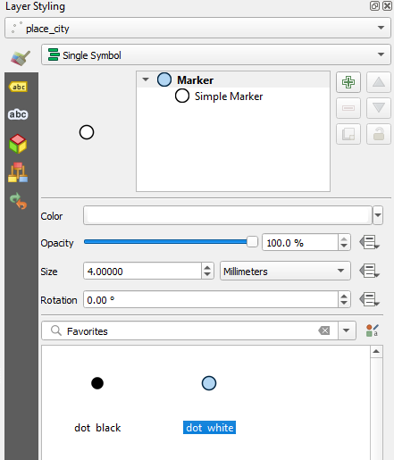
12. Click on Simple Marker and change the Stroke style to No Pen to remove the outline that we don't need.
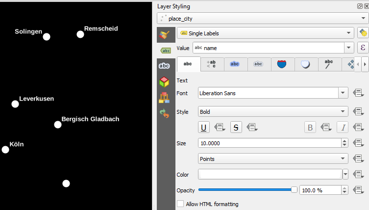
Besides the dots we also want to show the names of the cities. We'll also make them white so they pop out of the 3D map.
13. In the Layer Styling panel go to the Label  tab .
tab .
14. Choose Single Labels and for Value choose the Name field.
15. Go to the Font  tab and choose Liberation Sans with Style Bold.