Tutorial: Open Data for Precision Agriculture
4. Add RGB and Infrared aerial photographs
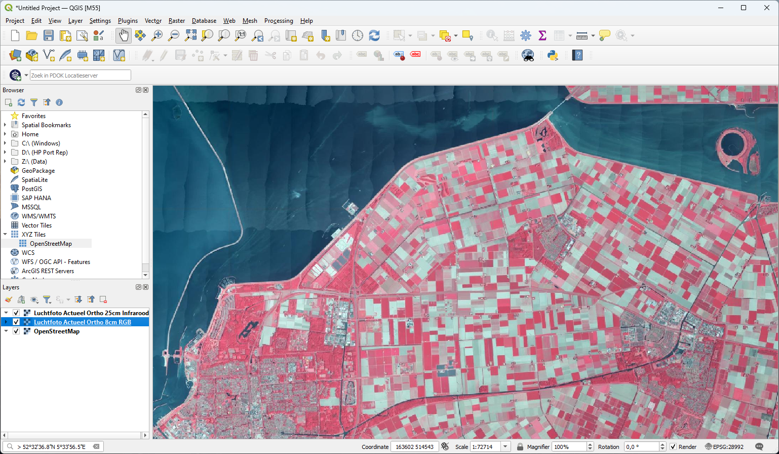
To better orient ourselves, we can add aerial photographs to our project. We'll first add an RGB (red, green, blue) aerial photograph layer that gives us visual information. Next, we'll add a false color aerial photograph layer, which shows near infrared reflection in red, which is useful for detecting natural vegetation cover and crops.
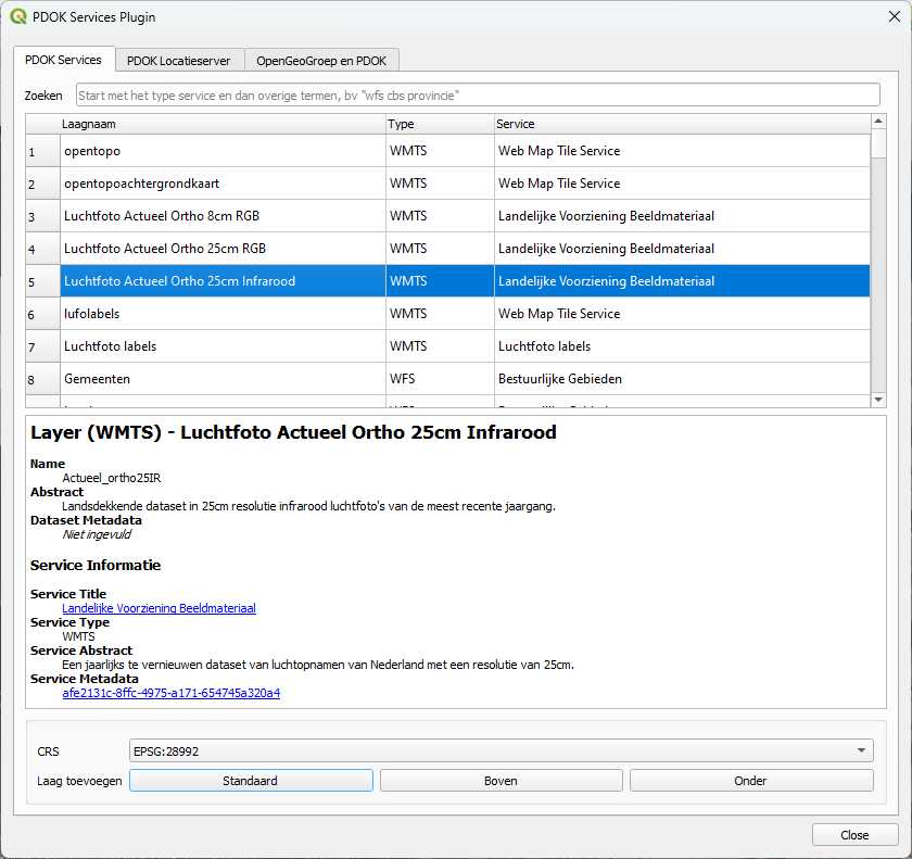
1. Click the  icon in the toolbar to open the PDOK Services Plugin dialog.
The dialog is in Dutch, but is quite easy to understand:
Zoeken = search
Laagnaam = layer name
Type = OGC service (WMS, WMTS, WFS, WCS)
Service = description of the layer/service
2. Search for Luchtfoto Actueel Ortho 8cm RGB (luchtfoto means aerial photograpj) and click on the layer name.
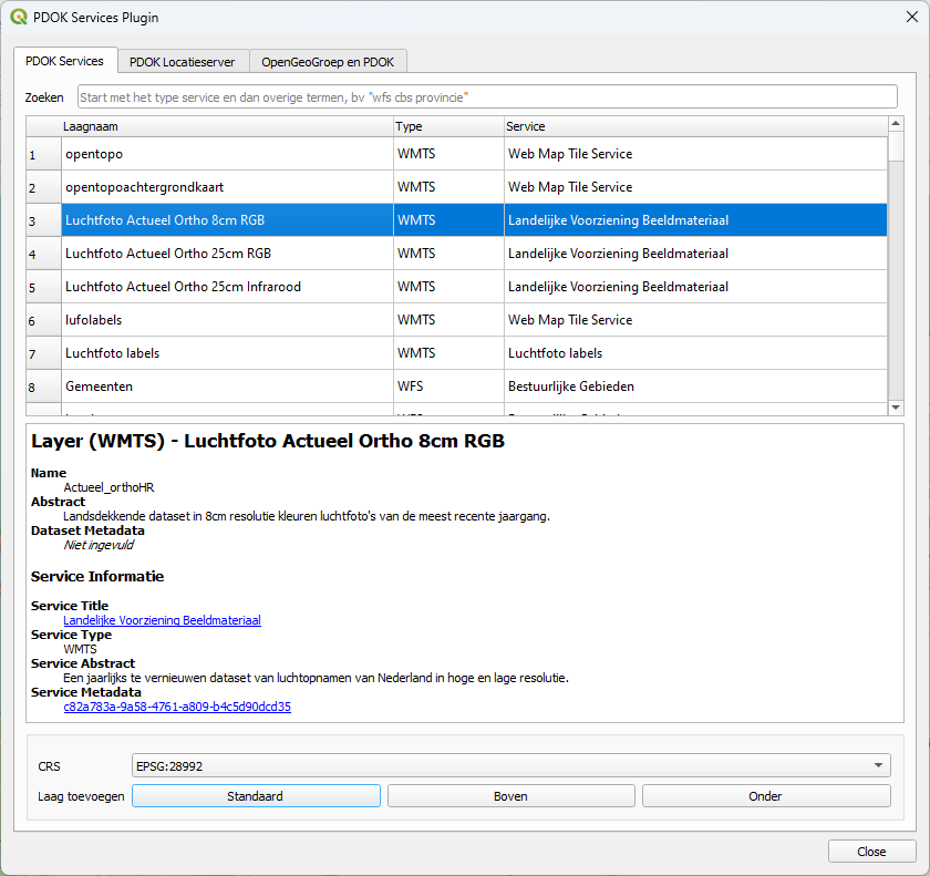
The lower part of the dialog now shows the metadata for this layer. The aerial photographs are obtained every year. This is the most recent one. Below the metadata you can choose the coordinate reference system (CRS). The default is the Dutch Amersfoort RD New projection (EPSG: 28992), which we'll also use in our project. Below the projection you can choose where in the Layers panel the layer needs to be added:
- Standaard: default
- Boven: add layer at top of the Layers panel
- Onder: add layer at bottom of the Layers panel
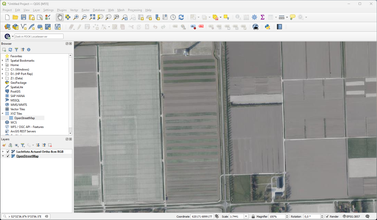
- Can you see which parcels have growing crops?