Tutorial: Delineate multiple subcatchments
5. Delineate all subcatchments in a catchment
In a similar way we can delineate all subcatchments of the Rur catchment. However, that would be a lot of manual work for digitizing and snapping the pour points.
In this section we'll derive the river junctions and apply the Points to catchments tool to all junctions.
1. In the Processing Toolbox choose SAGA | Terrain Analysis - Channels | Channel network and drainage basins.
2. In the dialogue choose the Filled DEM for Elevation and use a Strahler Threshold of 8 (this is calibrated in the stream & catchment delineation procedure). Uncheck all outputs except Junctions and save the shapefile to junctions.shp to your project folder.

3. Click Run and Close the dialogue after processing.
The junctions layer covers more than the Rur catchment so we need to clip it first.
4. In the main menu go to Vector | Geoprocessing Tools | Clip...

5. In the Clip dialogue choose the junctions layer as Input layer and the Rur catchment boundary as Overlay layer. Save the Clipped layer to the GeoPackage of this project and name it Rur junctions.

6. Click Run and Close the dialogue after processing.
7. Remove the junctions layer from the Layers panel.
8. Click right on the junctions layer in the Layers panel and choose Open Attribute Table.
In the attribute table you see that the field Type shows if a junction is a spring or a junction. We only need the junctions, because these are the subcatchment outlets. We're going to remove the springs.

9. In the attribute table toggle on the editing by clicking  .
.
10. Click on the Select features using an expression button  .
.
11. In the Select by Expression dialogue write the following expression:
"TYPE" = 'Spring'

13. Now click the Delete selected features button  .
.
14. Toggle off editing mode with the button and click Save. Close the attribute table.
This point layer has a MultipointZM geometry that we can't use. We have to convert it to a layer with a normal point geometry.
15. In the main menu go to Vector | Geometry Tools | Multipart to Singleparts...

16. In the Multipart to Singleparts dialogue choose Rur junctions as Input layer and save the Single parts layer to the GeoPackage of this project with the name outlets.

17. Click Run and Close the dialogue after processing.
18. Remove Rur junctions from the Layers panel.
Now we can apply the Catchments for points tool to all junctions to delineate their catchments.
19. In the Processing Toolbox choose Scripts | Hydrology | Catchments for Points.
20. In the dialogue select Outlets as Outflow point layer and Filled DEM as DEM layer.
21. Select a new Output Directory where the GeoPackage of all subcatchments will be stored.
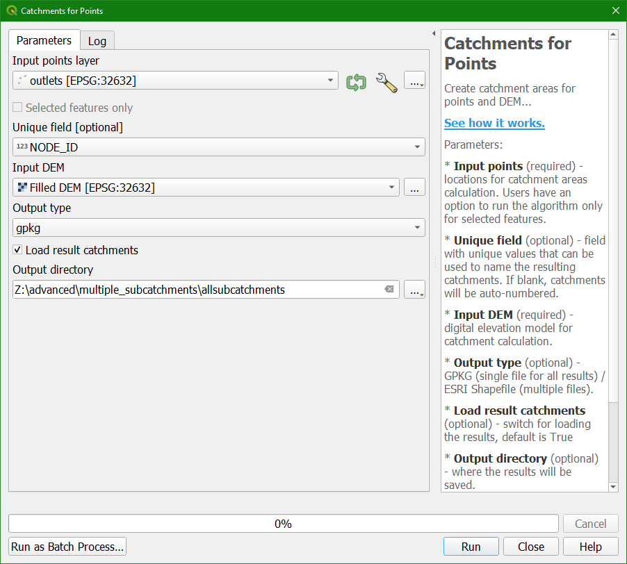
22. Click Run. This will take some time. Click Close when all points are processed.
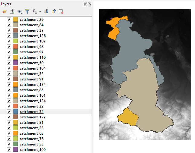
After some patience the layers are added to the map canvas: