Tutorial Stream and Catchment Delineation using PCRaster in QGIS
9. Define Outflow Point
A catchment is an extent or an area of land where surface water from rain, melting snow, or ice converges to a single point at a lower elevation, usually the exit of the basin, where the waters join another water body, such as a river, lake, reservoir, estuary, wetland, sea, or ocean. In order to delineate a catchment we need to have:
- the coordinates of our outlet in the same coordinate system as the map we are using
- the channel network that matches the flow directions as calculated from a hydrologically correct DEM
The outflow point of the Rur catchment is in Roermond, where the Rur enters the Meuse river (Maas in Dutch). The channel network that has been derived in the previous step is in the channels layer.
1. Make sure you have the channelsstrahler layer on top of the OSM Standard layer from the QuickMapServices plugin.
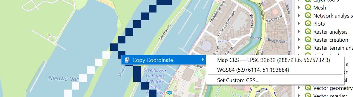
2. Look for the location where the Rur river flows into the Meuse. Note that on the OpenStreetMap the Dutch names are used, because it lies in the Netherlands. Rur is spelled as Roer and Meuse is spelled as Maas.
Note that the delineated channels are not corresponding well with the channels on OpenStreetMap. This can be for the following reasons: (1) Incorrect automatic delineation of streams, which can be caused by errors in the DEM or areas that are too flat, (2) Distortion due to (on-the-fly) reprojection and (3) Human influence on the natural course of the channels. The catchment delineation, however, only works when the outlet is defined on a delineated channel, because that corresponds with the filled DEM.
3. Choose a point on the delineated channel that is close to the real outlet of the Rur in the Meuse (step 2).
4. Click right on the pixel and copy the coordinate.
5. Paste the coordinates in a text editor (e.g. Notepad) and add a comma and a 1:
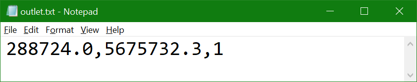
We've added the ID 1 to the coordinate. You can add more outlets to the file with unique ID's if you want to delineate (sub)catchments for multiple outlets.
6. Save the file as outlet.txt.
7. In the Processing Toolbox go to PCRaster | Data management | Column file to PCRaster Map.
8. In the Column File to PCRaster Map dialogue browse to the text file with the outlet, choose flowdirection as the Raster mask layer, choose Nominal as the Output data type and save the file as outlet.map.
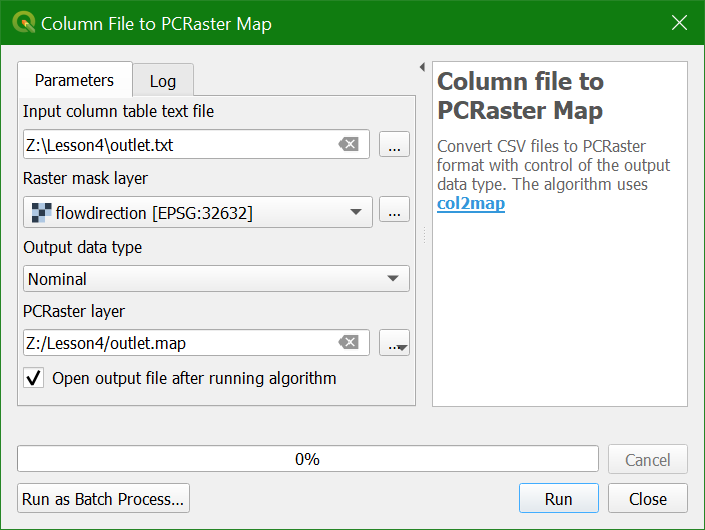
9. Click Run and Close after processing.
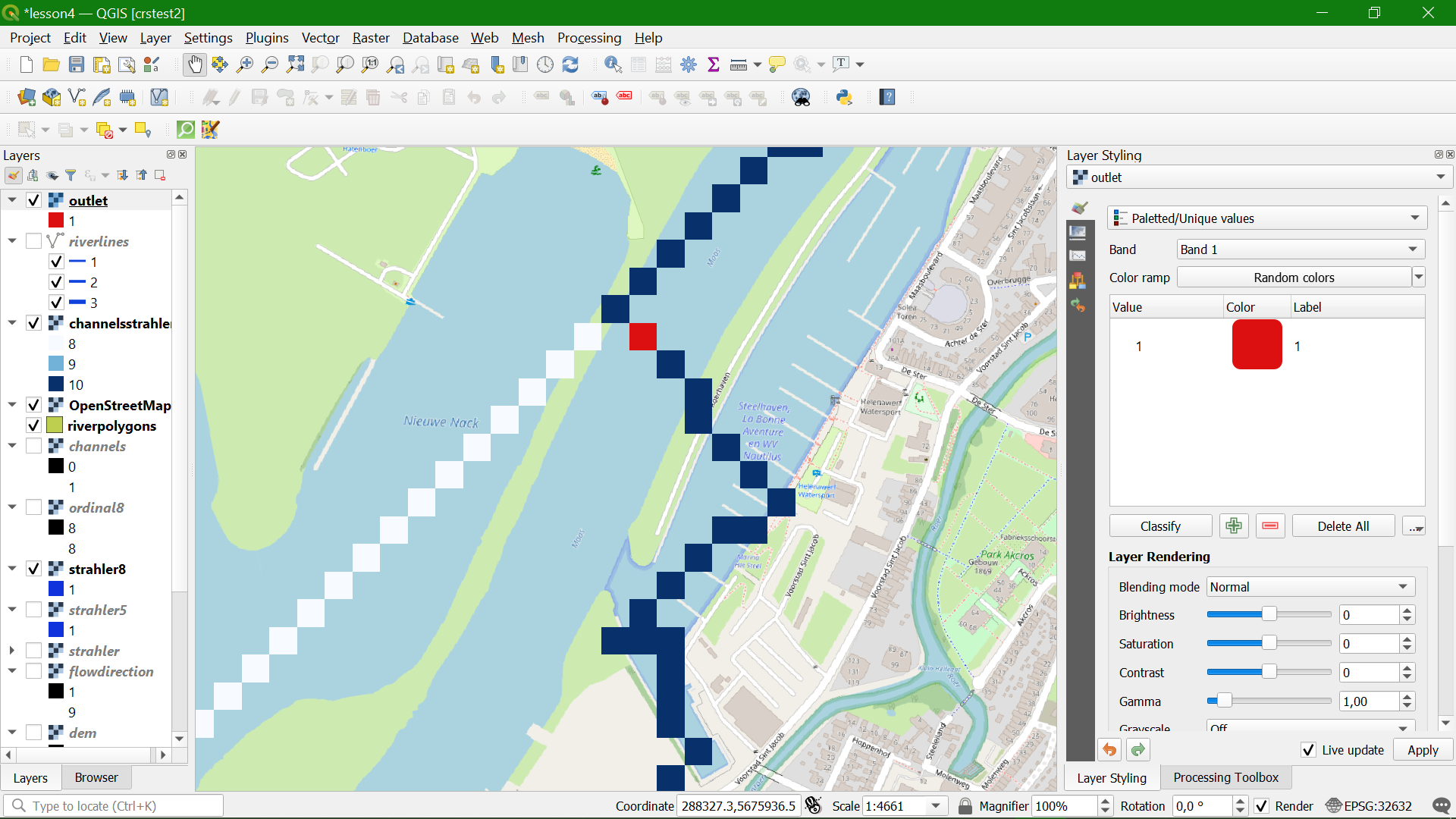
Now the outlet point has been added to the map canvas.
10. style the point with a clear colour using the paletted/unique values renderer.
In the next section we'll delineate the catchment of this outlet.