
Tutorial: Burn stream network into DEM
2. Download river line vectors from OpenStreetMap
In this section we're going to download all river line vectors in the study area from OpenStreetMap.
1. Start QGIS Desktop.
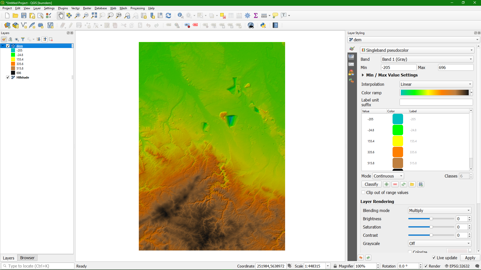
2. Add the provided dem.tif layer to the Layers panel.
3. Style the DEM layer, using a colour ramp and blending with hillshade.
The next step is to install the QuickOSM plugin.
4. In the main menu go to Plugins | Manage and Install Plugins...
5. Search for QuickOSM and click Install Plugin and Close the dialogue.

Now we're going to download river data from OpenStreetMap.
6. In the toolbar, click  to open the QuickOSM dialog. Accept the licence in the popup.
7. In the QuickOSM dialog, go to the Quick query tab and choose for Key waterway and for Value river. For Layer Extent choose DEM. Expand Advanced and make sure that only line features are selected. The dialogue should look like the picture below.
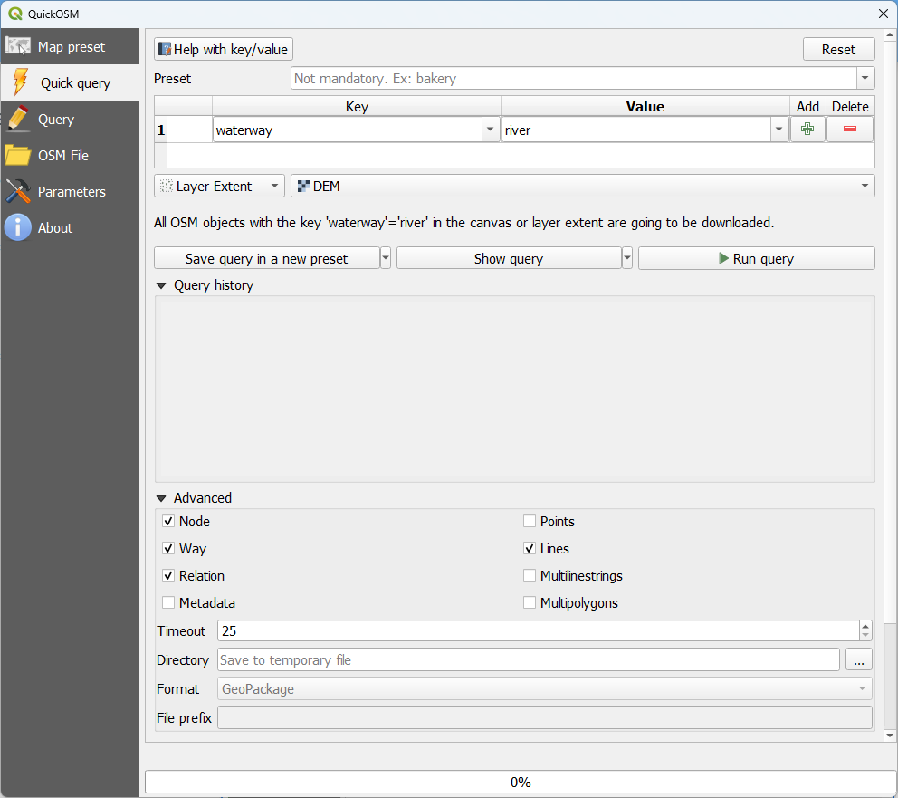
8. Click Run query. Close the window when the message "Successful query, 1 layer(s) has loaded." appears.
Now you have all rivers in the study area.
In the next section we're going to select the Rur river and export it to a new layer.