
Tutorial: Stream and Catchment Delineation
8. Delineate Streams
8.2. Calibrate Strahler Threshold to Determine Streams
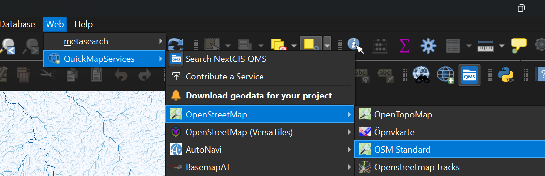
The next step is to apply a calibration procedure to determine which Strahler orders we consider to be streams. We will create boolean layers for Strahler orders larger than or equal to a threshold value. Each boolean layer will be compared with a reference layer. Here we will compare the Strahler orders with the rivers on OpenStreetMap. For areas where there is a lack of data in OpenStreetMap, you could use the Google Satellite. Both OpenStreetMap and Google Satellite layers can be found in the NextGIS QuickMapServices plugin.

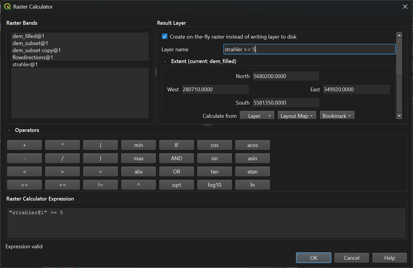
3. Fill in the dialogue as in the figure below. You can double click on a layer name to add it to the expression. Note that we check the box to Create on-the-fly raster instead of writing layer to disk, because we only need these layers for calibration purposes. Choose strahler >= 5 as the Layer name so we can compare results later. Click OK to run the calculation.
It is also good practice to style the strahler5.
4. Go to the Layer Styling panel and make sure that strahler >= 5 is selected.
5. Choose Paletted/Unique values from the drop-down menu.
This layer is boolean and therefore it has only pixels with values 0 and 1, but it also shows a nodata value. For our calibration it is important to make the ones blue and the rest of the pixels transparent so we can compare the raster with the streams on OpenStreetMap.
 to remove these classes.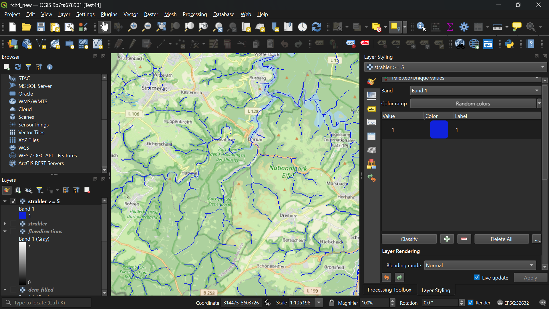
On the map canvas we can see now all streams larger than or equal to Strahler order 5 and we can compare them with the rivers on the OpenStreetMap.
8. Repeat the steps in this subsection for different Strahler order threshold values and determine the one that corresponds best with the rivers on OpenStreetMap. Remove the other boolean layers and save the final one as channels.tif.
Tip: You can copy the styles of the layers: right-click on a layer, choose Styles | Copy Style and then right-click on the target layer and choose Styles | Paste Style.