Tutorial: Create a groundwater quality map from borehole data
2. Load a boreholes dataset from a GeoNode SDI
We'll start with loading a boreholes dataset from a GeoNode SDI to QGIS.
In this tutorial we'll use the Borehole Database in the Stampriet Transboundary Aquifer from the Orange-Senqu River Basin GIS Server, which is a GeoNode SDI.
1. Check the metadata of the Borehole Database in the Stampriet Transboundary Aquifer. Read the info tab and check the attributes that are in the layer.

2. Start QGIS with an empty project.
3. Click the Open Data Source Manager button  in the toolbar.
4. Choose the GeoNode tab.

5. Click the New button to create a new service connection.
6. In the Create a New GeoNode Connection dialogue type ORASECOM for the Name and copy the URL http://gis.orasecom.org.

7. Click Test Connection.
If the test is successful you'll see this popup:

If the connection fails, check your internet connection and the URL. You can also try to continue and see if the layers are shown when you click Connect.
8. Click OK to close the popup.
9. Click OK in the dialogue to close it and the new connection is added.
10. Click the Connect button.
If you'll get an error in a popup that you can ignore. Click OK to remove the error message.

Then you'll see the layers on the GeoNode listed.
We're going to use data from the Stampriet aquifer.
11. Type stampriet at filter.

12. Click stasboreholes WFS layer (indicated in the figure above).
We use a WFS Web service, because we want to access the data and not just a picture like with WMS data.
13. Click Add to add the layer to the map canvas.
14. Click Close to close the dialogue.
It will take a while to load from the internet.

Just wait until loading has completed. Then you'll see this:

To check if the location of the boreholes makes sense we'll add a backdrop from OpenStreetMap.
15. Go to the Browser panel, expand XYZ Tiles and drag the OpenStreetMap layer to the map canvas. Make sure that the point layer is on top.
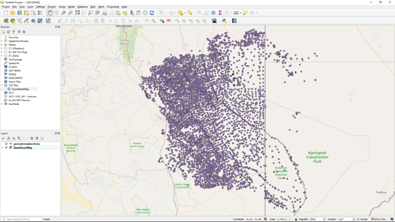
This looks correct.
In the next section we're going save this WFS layer to a GeoPackage to further use locally.