Tutorial: Create a groundwater quality map from borehole data
3. Export WFS data to GeoPackage
Our borehole dataset is still in the WFS format and in a Geographic Coordinate System (GCS) with coordinates in degrees latitude/longitude. For our purpose of interpolating elevation, we need to store the file locally and reproject it to UTM Zone 34S/WGS-84.
1. In the Layers panel click right on the geonode:stasboreholes layer.
2. Choose Export | Save features as...

3. In the Save Vector Layer as... dialogue choose GeoPackage as the Format. Click the  button to browse to a folder on your harddisk where you want to store the GeoPackage (e.g. Z:\Stampriet). Name it Stampriet_Data.gpkg. Type for Layer name Boreholes.

4. Click the  button to change the projection of the output layer.
5. In the Coordinate Reference System Selector dialogue type 32734 (that's the EPSG code) at Filter to search for the WGS 84 / UTM Zone 34S projection. Click on the projection name and click OK to return to the dialogue window.

6. Click OK to perform the export.
7. After the Stampriet_Data Boreholes layer has been added to the map canvas, remove the geonode:stasboreholes layer by clicking right on it and choose Remove layer.... Confirm with OK.
Now we have a local copy of the boreholes layer.
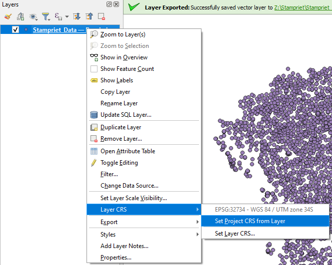
8. Change the OTF projection of the project: in the Layers panel click right on Stampriet_Data Boreholes and choose Set CRS | Set Project CRS from Layer
9. Save the project in the GeoPackage. Call it Stampriet.
In the next section we're going to interpolate the NO3 values of the boreholes data.