Tutorial: Create a groundwater quality map from borehole data
4. Interpolate groundwater quality data
4.3. Inverse Distance Weighting
In this section we'll use the Inverse Distance Weighting (IDW) interpolation method. This method uses by default an exponential decay function for the weight of measurements as function of distance to the measurements. This works well with a high density of points.
You can find the IDW tool under Raster | Analysis | Grid (Inverse Distance to a Power)..., but we're going to use a similar tool from the Processing Toolbox, because there we can control the extent and spatial resolution of the raster output layer.
1. You can open the Processing Toolbox panel by clicking the gear  icon in the toolbar.
2. In the Processing Toolbox choose Interpolation | IDW interpolation.
3. In the IDW Interpolation dialog choose the NO3 layer as Input layer and the NO3_mg_l field as Interpolation attribute. Click the  icon to add the points. Keep the Distance coefficient P at 2 for an exponential function. For Extent, use the dropdown menu to point to the extent of the NO3 point layer. Change the pixel size to 5000 m and save the result to NO3_IDW.tif.
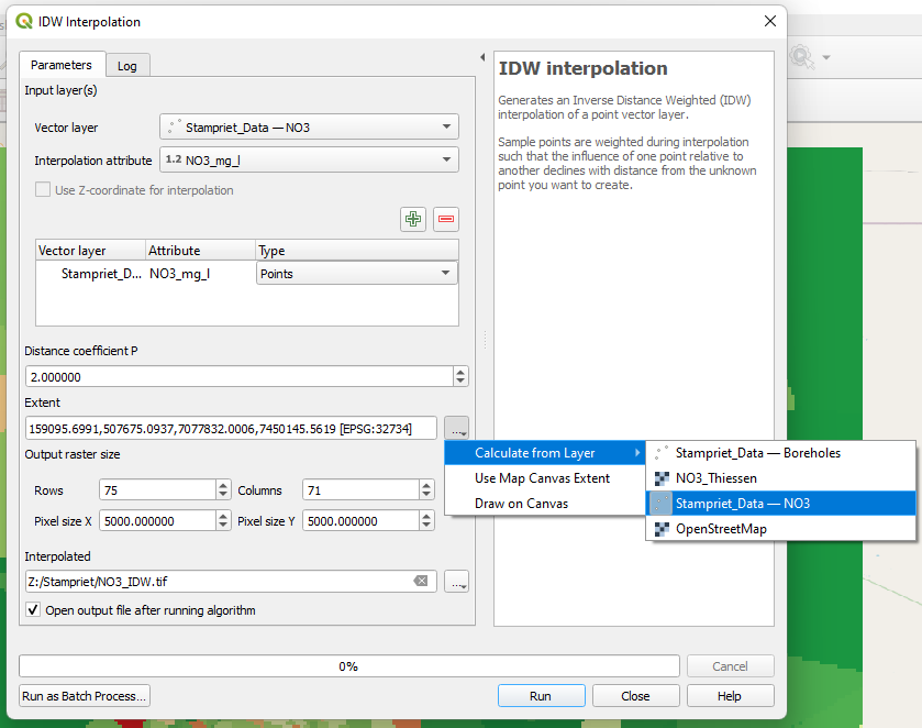
4. Click Run. Click Close after processing.
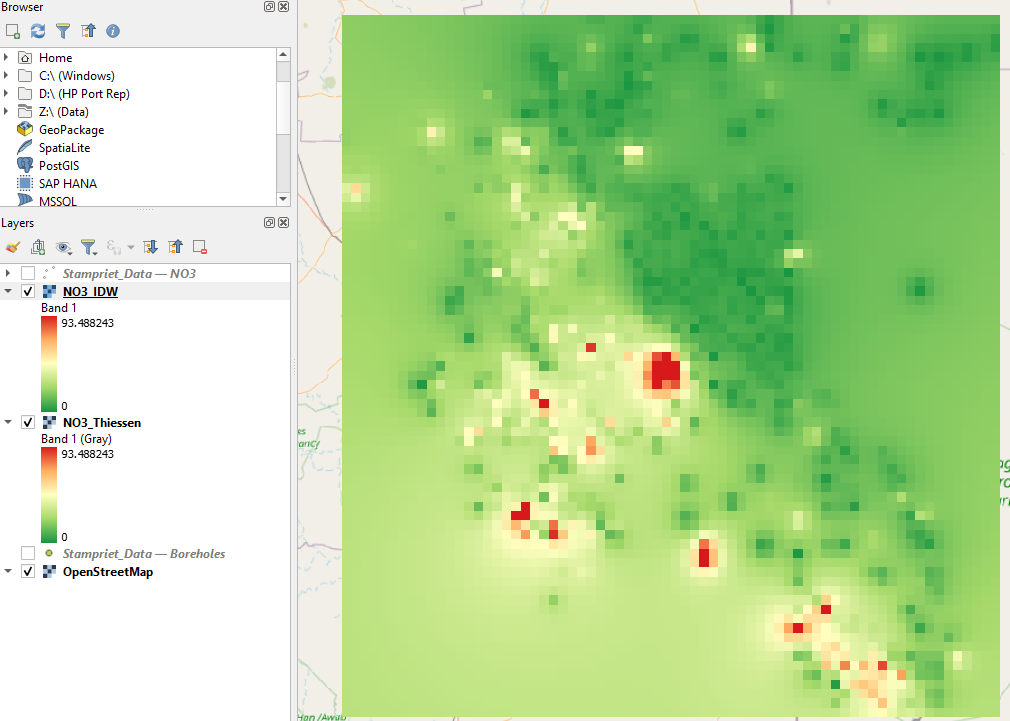
5. Copy the style from the Thiessen result to the IDW raster so they can be compared. You can do this easily by right-clicking on the Thiessen layer and choose Styles | Copy Style from the context menu. Then choose Styles | Paste Style for the IDW layer.
The result for IDW should look like this:
In the next section we'll use kriging as interpolation method.