
Tutorial: Create and Use Virtual Point Clouds (VPC)
Completion requirements
2. Download AHN4 tiles
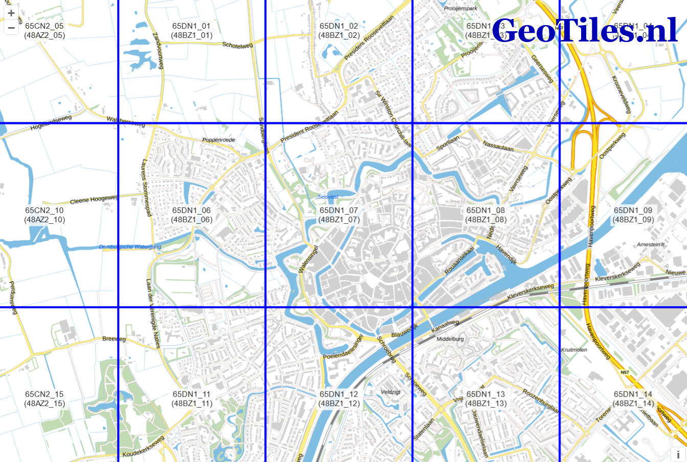
In this workshop we're using AHN4 point cloud tiles of the Netherlands, that can be downloaded from Geotiles.nl. Feel free to use your own LAZ data. For Estonia, data is available here.
1. In a web browser go to Geotiles.nl
2. Download the tiles of a city of your choice, by zooming in until you see the subtiles. Save the tiles in a dedicated folder on your hard drive.
In this workshop we'll use Middelburg as an example. For the historic center of Middelburg you can download the following tiles:
- 65DN1_07.LAZ
- 65DN1_08.LAZ
- 65DN1_12.LAZ
- 65DN1_13.LAZ
Note that LAZ is a point cloud file format. It is a compressed (Zipped) version of a LAS file. These are PDAL supported formats. PDAL, or Point Data Abstraction Library, is a C++ library for translating and manipulating point cloud data. It is similar to the GDAL library, which handles raster and vector data.
In the next chapter, we'll load the tiles in QGIS.