
Tutorial: Irrigation Performance Indicators and Water Productivity
2. Loading the Study Area Boundary
We'll start with loading the polygon of the study area in QGIS.
1. Download the shapefile provided for the tutorial, which represents an agricultural plot in Oued Hellal, Sudan. Unzip the file in a folder on your hard drive.
2. Start QGIS Desktop.
3. Load the shapefile into your project. There are two ways:
- Go to main menu and choose Layer | Add Layer | Add Vector Layer and select the shapefile.
- Locate the shapefile in the Browser panel and drag it to the map canvas.
To have some more context of the study area, we'll add a satellite image as a base map. We'll use the QuickMapServices plugin.
4. Install the QuickMapServices plugin: in the main menu, go to Plugins | Manage and Install Plugins, search for QuickMapServices, and install it.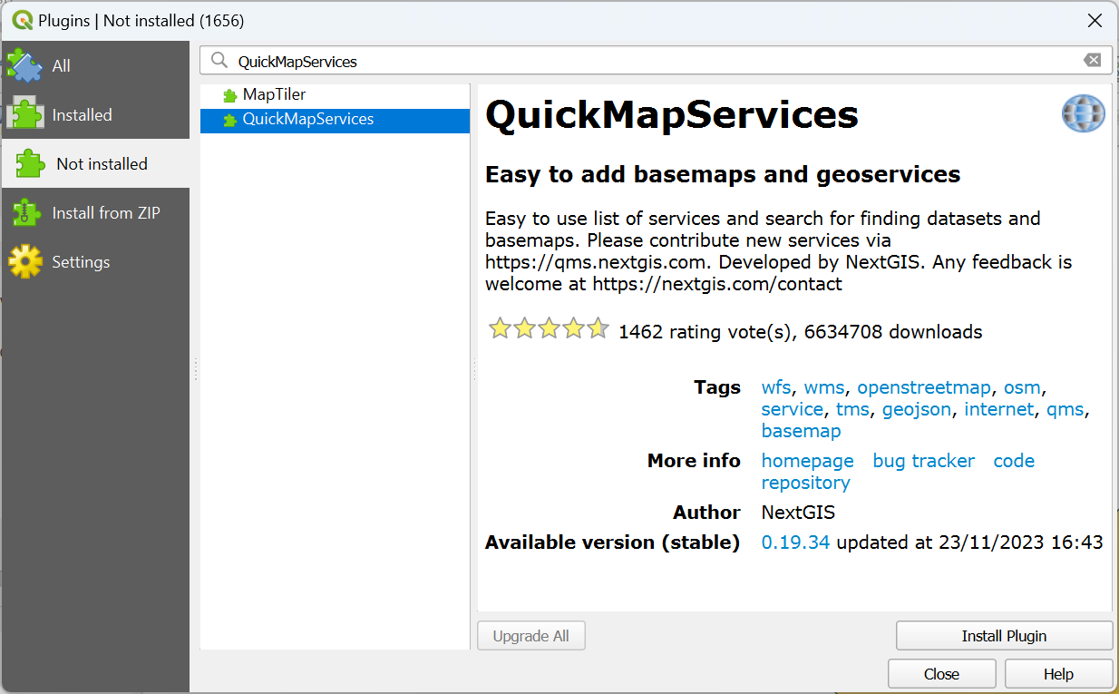
Next, we need to configure access to additional services, because the Google Satellite image is not available by default.
5. In the main menu, go to Web | QuickMapServices | Settings.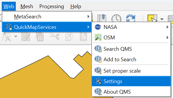
6. In the QuickMapServices dialog go to the More services tab and click the Get contributed pack button.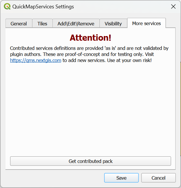
7. Click OK in the popup and Save to close the dialog.
8. Now add the Google Satellite by choosing from the main menu Web | QuickMapServices | Google | Google Satellite.
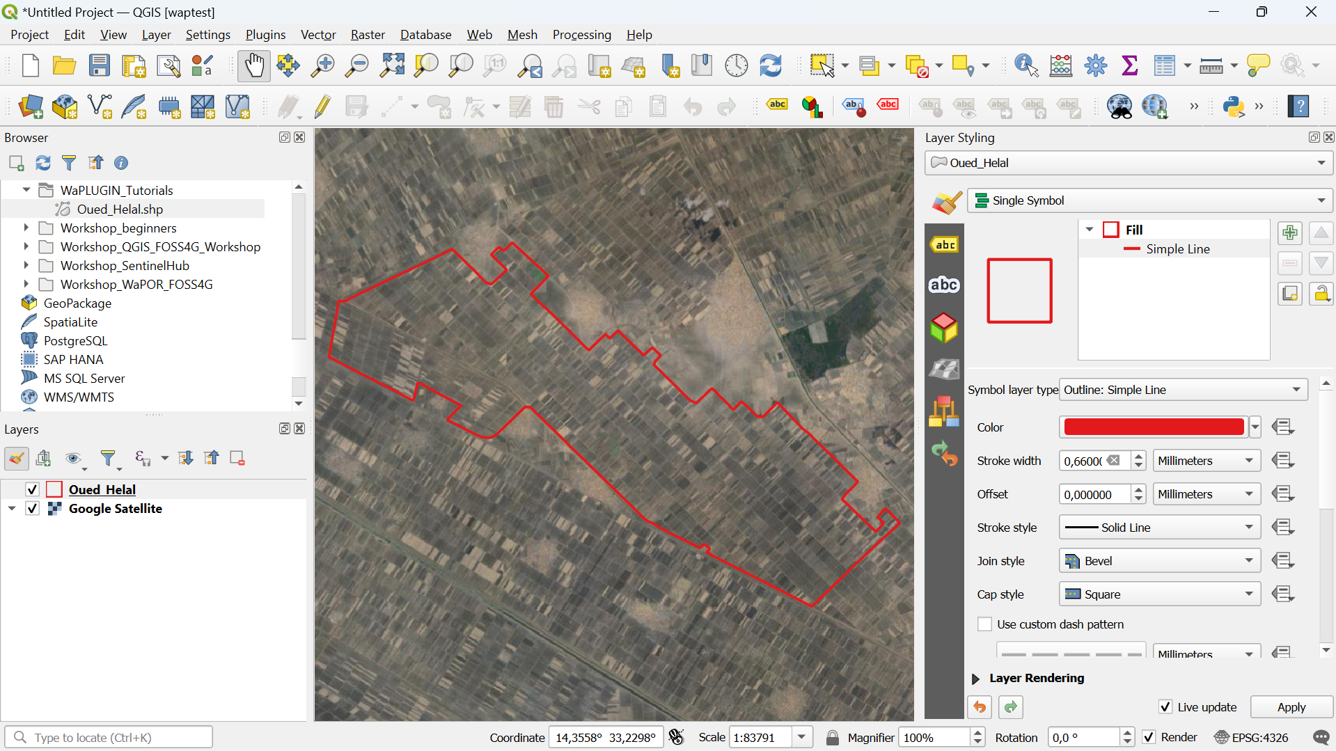
It's better to show only the boundary, so we can see the parcels on the satellite image.
9. In the Layers panel select the Oued Helal layer and click  to open the Layer Styling panel.
10. In the Layer Styling panel click on Simple Fill and change the Symbol layer type to Outline: Simple Line. Change the colour to red and make the line a little thicker.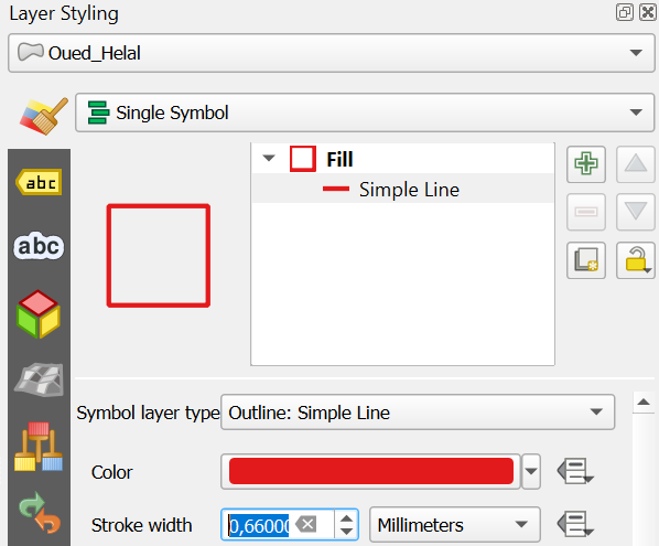
Now you can see the study area.
Now we can proceed with downloading WaPOR data for this area using the WaPLUGIN.