
Tutorial: Delineate multiple (sub)catchments
3. The Pit Tool
An easy way to find outlets of (sub)catchments in your DEM is to use the pit tool.
A pit is a cell in which all surrounding neighbors have a drainage direction that leads toward the pit cell. Unlike other cells, a pit does not possess a local drainage direction because all adjacent cells are situated at a higher elevation. Additionally, the outflow cell of each catchment—positioned at the edge of the map—is also considered a pit. In a local drainage direction network, pit cells are assigned the value 5.
1.In the Processing Toolbox, double click on the pit tool.
2. In the dialog, choose the flowdirection layer as LDD layer and create an Output pit raster layer with the name pits.map.
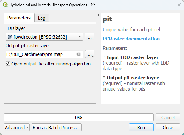
3. Click Run. Click Close after processing.
4. Style the result with Random colors with the Paletted/Unique values renderer in the Layer Styling panel.
You'll see that it has found many pits.
Let's derive their catchments.
5. Use the catchment tool to derive the catchments of the pits layer.

Note that you can more or less recognise the Rur catchment derived in the first tutorial. You can also see a lot of artefacts at the border of the study area.
Here's a video showing an example of using the pit tool:
For automatically deriving all subcatchments, it's more useful to look at the junctions of tributaries. We'll do that in the next chapter.