
Tutorial: Editing Point Clouds
5. Editing Tools
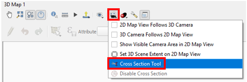
5.3. Cross Section Tool
This cross section tool allows you to define a rectangular area to for which you can create a cross section.
1. To enable the cross section tool find the Camera ![]() button in your 3D View toolbar and choose Cross Section Tool.
button in your 3D View toolbar and choose Cross Section Tool.
2. Then in your 2D View pick two points and the width you want to cross section. QGIS will basically spatially filter the points to exclude everything beyond your defined cross section rectangle.
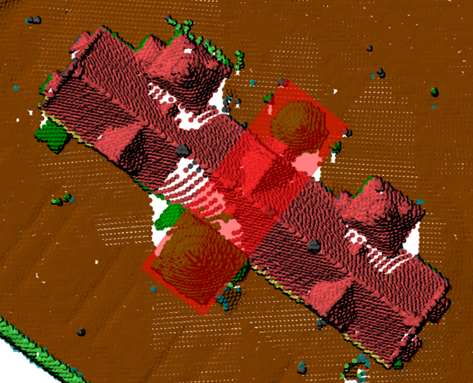
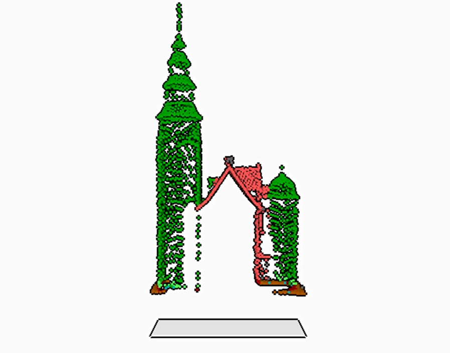
3. The result appears as a cross section in your 3D View.
Note: You can eliminate the gray rectangle below by entering the 3D Settings and on the Terrain tab choosing a Terrain Type of Flat Terrain.
This provides another method of isolating specific points for editing, display or making measurements. This is another good option when the area you are needing to isolate does not fit within a square you can draw on the Map Canvas. It can be especially effect for editing when combined with Filtering.
When combined with constraining the 3D View, these tools allow you to precisely select the points which need to be edited.