
Tutorial: Use PDAL wrench to automate workflows
1. Introduction
In the previous tutorials we have used the point cloud processing tools available in the QGIS Processing Toolbox. You might have noticed every time you run a point cloud processing tool, it runs a PDAL wrench command. You could see that in the log tab of the dialog windows:
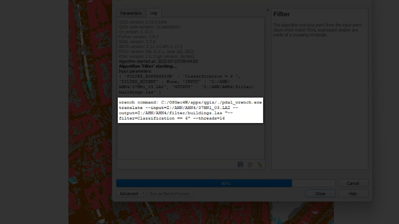
The arguments that you fill in in the dialog tab are parsed into the command string and executed. These commands can also be used to process point cloud data from the command line, which makes it easier to automate procedures.
The PDAL wrench repository on GitHub has a readme file with more information about the available PDAL wrench commands. If you're familiar with GDAL, you'll see that the commands are very similar.
In this tutorial we'll have a look at some of the commands.
After this tutorial, you'll be able to:
- Setup PDAL wrench
- Create a Virtual Point Cloud (VPC) layer from tiles
- Clip the VPC layer with a polygon layer
- Interpolate a point cloud to raster using TIN
- Merge point cloud tiles into one LAZ file
- Clip an LAZ file with a polygon layer
We'll create a digital surface model (DSM) of the center of Middelburg.