
In this section, we'll download buildings. In this case we'll use OpenStreetMap. We can download buildings from OpenStreetMap with the QuickOSM plugin.
This video shows how the plugin works:
1. Install the QuickOSM plugin.
2. In the toolbar, click  . Accept the license agreement in the popup.
3. In the QuickOSM dialog, type at Key building. Leave Value blank, so it will download all buildings. Click In and choose Canvas Extent. Then under Advanced uncheck the boxes for Points, Lines and Multilinestrings so we only download Polygons. Then click Run query. If the area is too large, zoom in a bit bore in the map canvas.

Now you see all buildings in the map canvas.
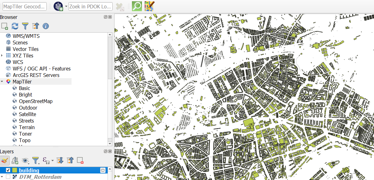
Note the  icon next to the layer. This means that the layer is a temporary scratch layer and that it can be lost if QGIS is closed. We have to make it permanent if we want to keep it.
One way is to click on the  icon. With this method, however, we can't control the output projection. It is good practice to reproject the layer immediately to the projection that we need.
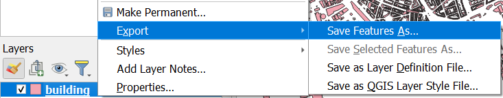
5. Right-click on the building layer and choose Export | Save Features As... from the context menu.
6. In the dialog, save the layer as buildings in the Rotterdam.gpkg GeoPackage. Change the CRS to the one of the project (EPSG:28992).
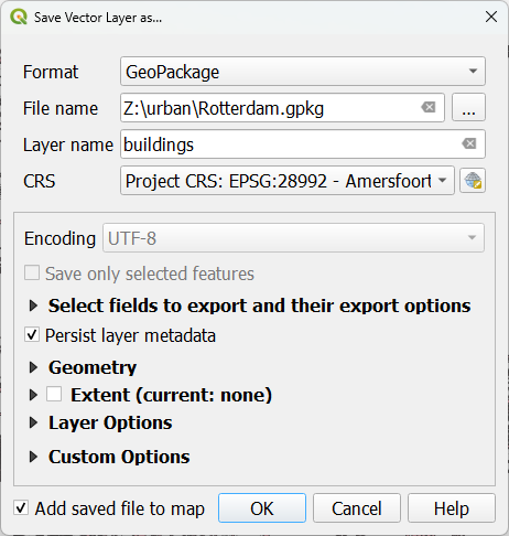
7. Click OK.
Now your buildings are stored in the GeoPacakge.
8. Remove the temporary building layer.
9. Save the project by clicking  .
.