
Let's assume that the land-use classes 23 (grass in primary built-up areas) and 28 (grass in secondary built-up areas) are potentially suitable. Let's create a a boolean raster that is true for these classes and false for all other classes. We can do this with the Raster Calculator.
1. In the main menu go to Raster | Raster Calculator....
2. Under Raster Bands, double-click on LGN2022_Rotterdam@1 to add it to the expression. Then complete the expression so it states:
"LGN2022_Rotterdam@1" = 23 OR "LGN2022_Rotterdam@1" = 28
Tip: click on the operators instead of typing them.
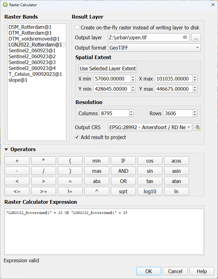
3. Save the result in the project folder and call it open.tif.
4. Click OK.
5. Go to the Layer Styling panel and make sure the open layer is active.
6. Use the Paletted/Unique values renderer and click Classify.
7. Change the Color for 0 to red and change the Label to Not open. In the same way, change the Color for 1 to green and change the Label to Open.
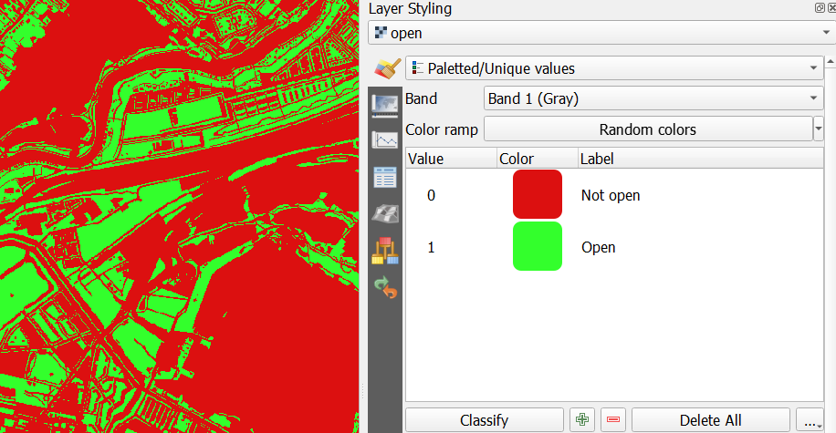
Now we see in green all the open patches in the city (based on our simple assumption).
However, we do not distinguish individual patches. Let's fix that in the next section.