
In the previous section, we have created a boolean raster with True (1) for open spaces and False (0) for other areas. To develop plans, we need to check individual open patches.
Before we can make the patches, we need to remove all False pixels by making them nodata. Then they're not considered as patches.
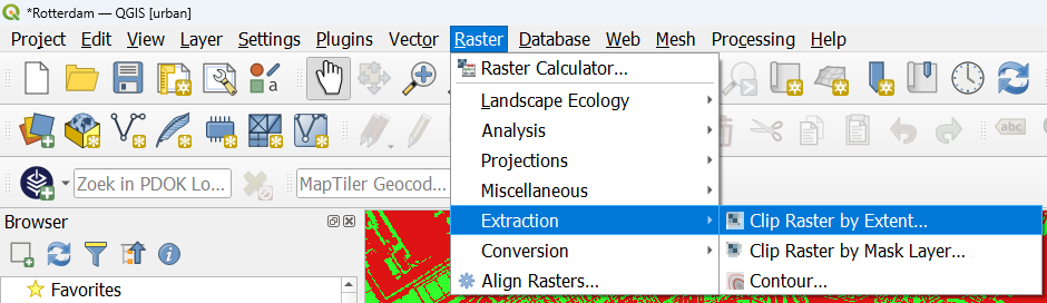
1. In the main menu, go to Raster | Extraction | Clip Raster by Extent....
2. In the Clip Raster by Extent dialog, make sure that open is chosen as the Input layer.
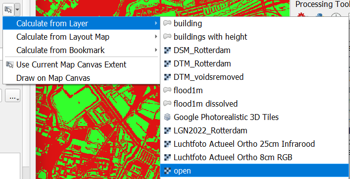
3. At Clipping extent, click the arrow to go to the drop-down menu and choose Calculate from Layer | open, so exactly the same extent as the input layer will be used.
4. To make all zeros nodata, set Assign a specified nodata value to output bands to 0.
5. Save the result to open_nodata.tif in your project folder.
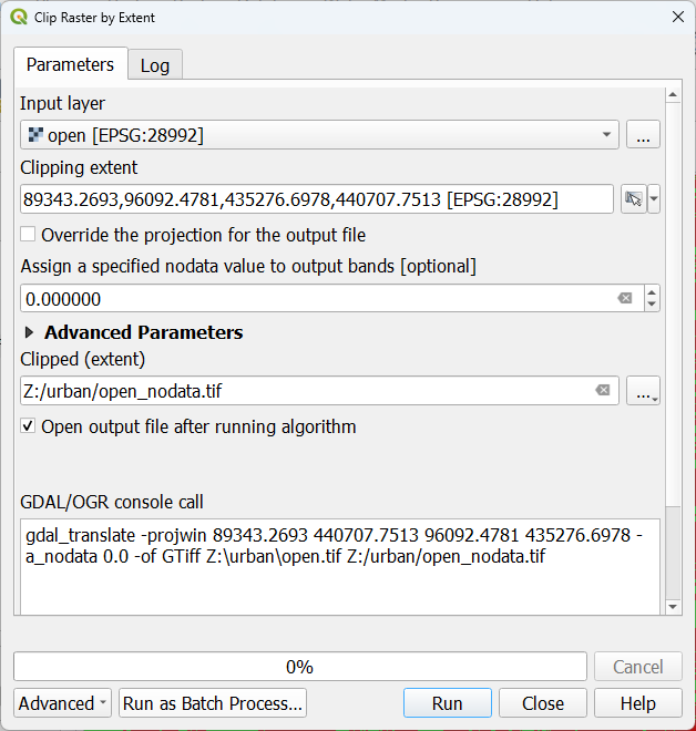
6. Click Run. Click Close after processing has completed.
7. Style the result layer in such a way that all cells with value 1 are green and labelled with Open.